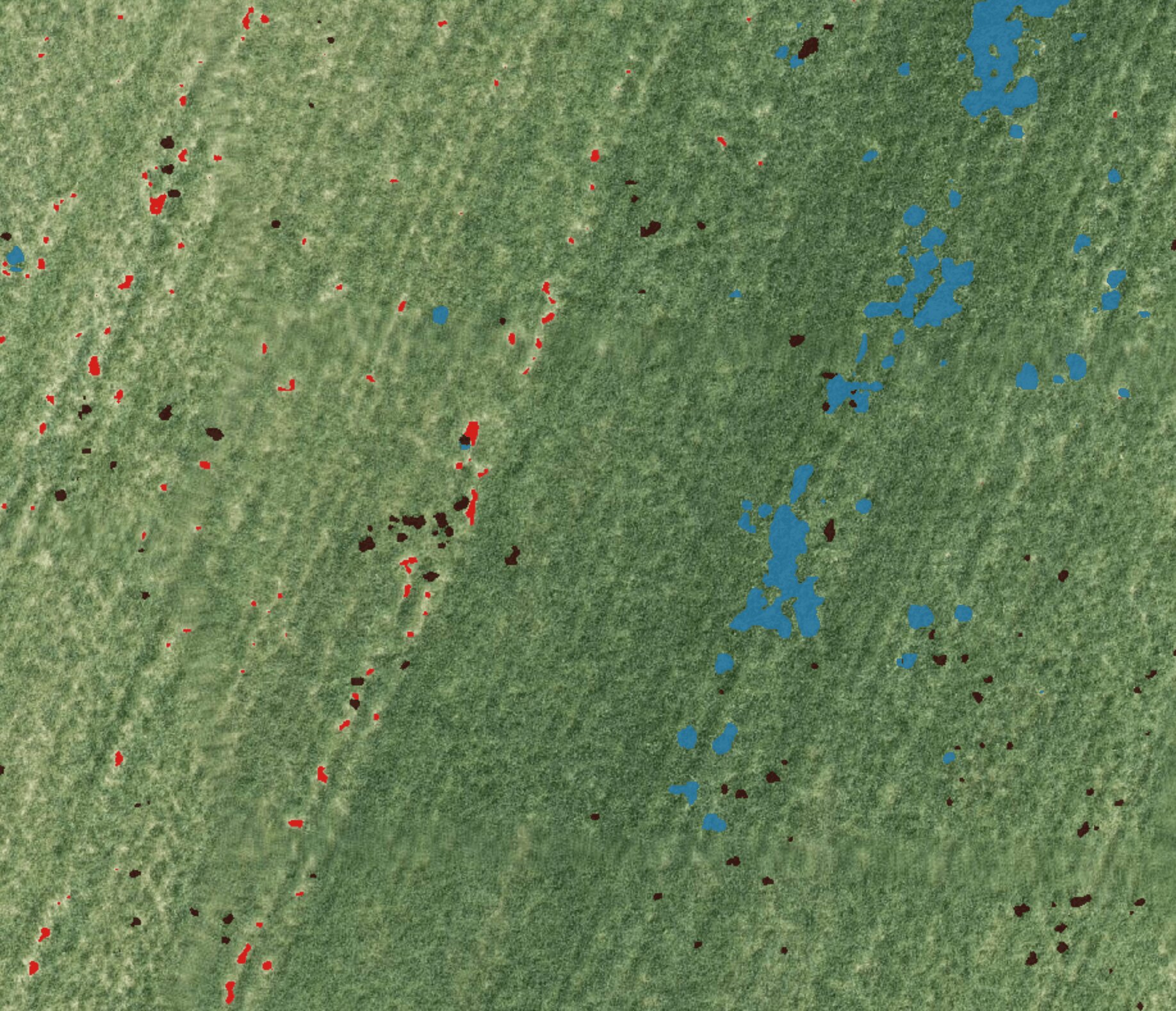
AI Weed Mapping
AI Weed Mapping
Learn more about how AI weed mapping works
Spray where the weeds are
The whole field may not need the same treatment. CropUp analyzes RGB drone images with AI, making it possible to create spray maps for targeted herbicide application.
HOW IT WORKS
From drone images to spray maps

Plan your flight
Quickly and easily plan your route on the platform so your drone is ready for takeoff.
Fly & upload
Capture high-resolution aerial photos of your field with your drone, then upload the images directly.

AI analysis
Our artificial intelligence precisely maps weeds, crops, and bare areas.
Download your spray map
Adjust the application rate and export your customized prescription map directly to your tractor.
WHEN DOES IT MAKE SENSE?
When weeds are unevenly distributed
When weeds are unevenly distributed and you want a more accurate understanding of treatment needs before spraying. Timing, crop, and image quality all affect the results.
POSSIBLE APPLICATIONS
What you can use the map for
- Identify areas with weeds in the field
- Create targeted spray maps
- Support decisions about where treatment is needed