For farms
For farms
More precision, less waste, and more value in the field.
Get more out of your fields. Use less where you can.
CropUp turns drone and satellite data into actionable decisions in the field. See variations, target your efforts, and get more value from your inputs—without making your day-to-day work more complicated.
WHY FARMERS CHOOSE CROPUP
Three benefits of CropUp
1
Targeted spraying
Spray where it’s needed—not uniformly across the entire field.
2
A clearer overview
Use CropUp to identify weeds, crop variation, and differences in plant density.
3
No new equipment needed
Export the map directly to the terminal you already use.
ONE PLATFORM, MORE POSSIBILITIES
From field imagery to action
Drone imagery can be turned into detailed maps of field conditions. The satellite forecast provides an earlier picture of expected variations in weed pressure. Choose the solution that fits the task—and use the results to plan and carry out more targeted treatments.
SOLUTIONS
Find the right solution
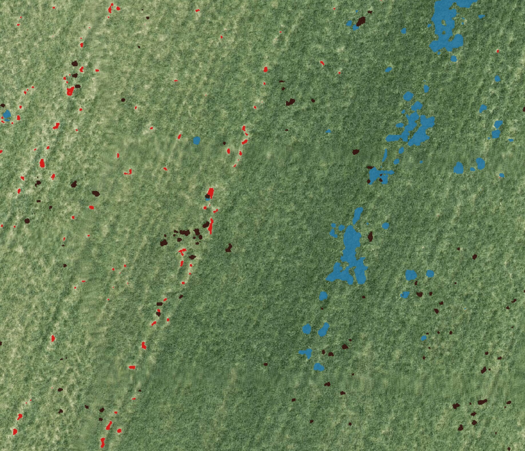
AI weed mapping
Identify weeds in drone imagery and create machine-ready maps for targeted herbicide application.
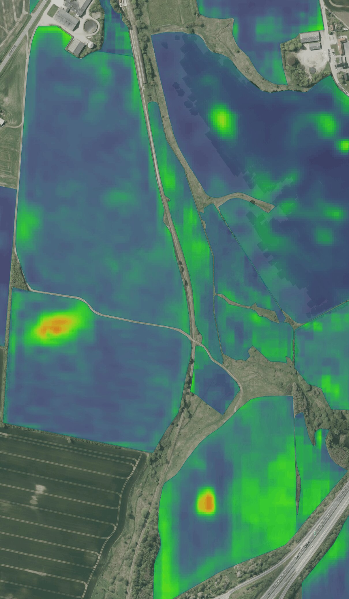
AI Satellite Forecast
See where weed pressure is expected to vary 1–2 years ahead, and use the zones for variable-rate application and planning.
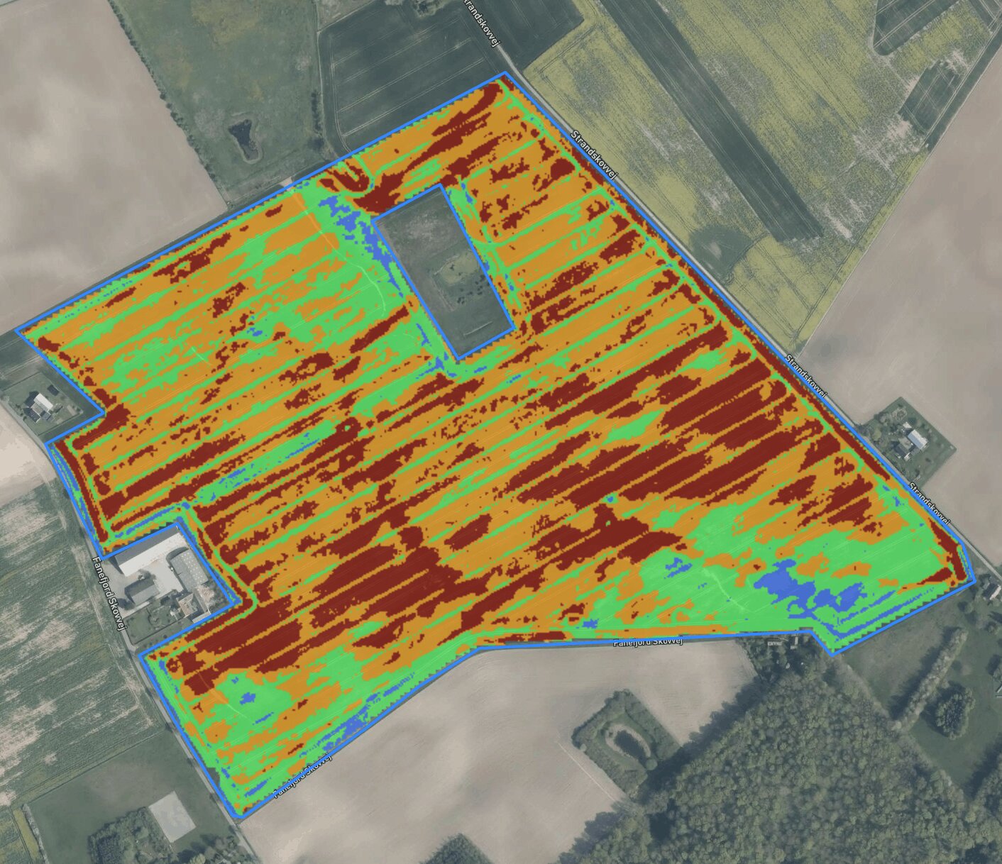
NDVI variable-rate tool
Use detailed drone-based vegetation data to divide fields into zones and create variable-rate application maps.
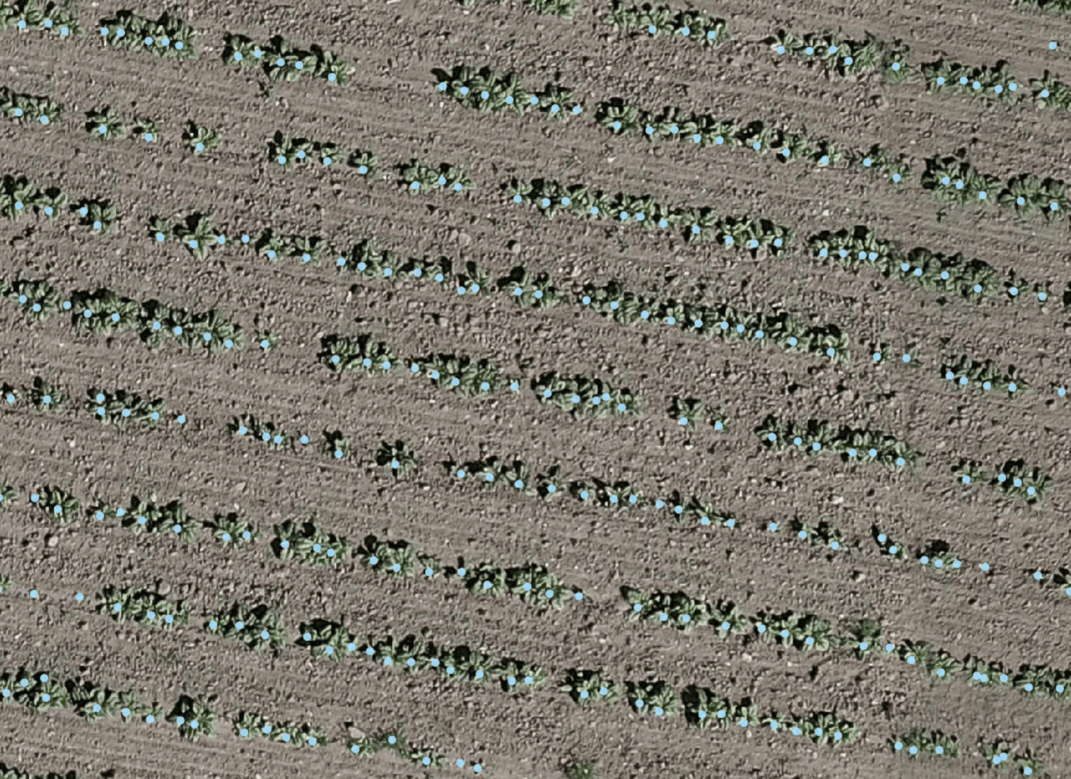
Plant counting system
Get an overview of plant counts and uneven emergence—even in parts of the field you don’t have time to count manually.
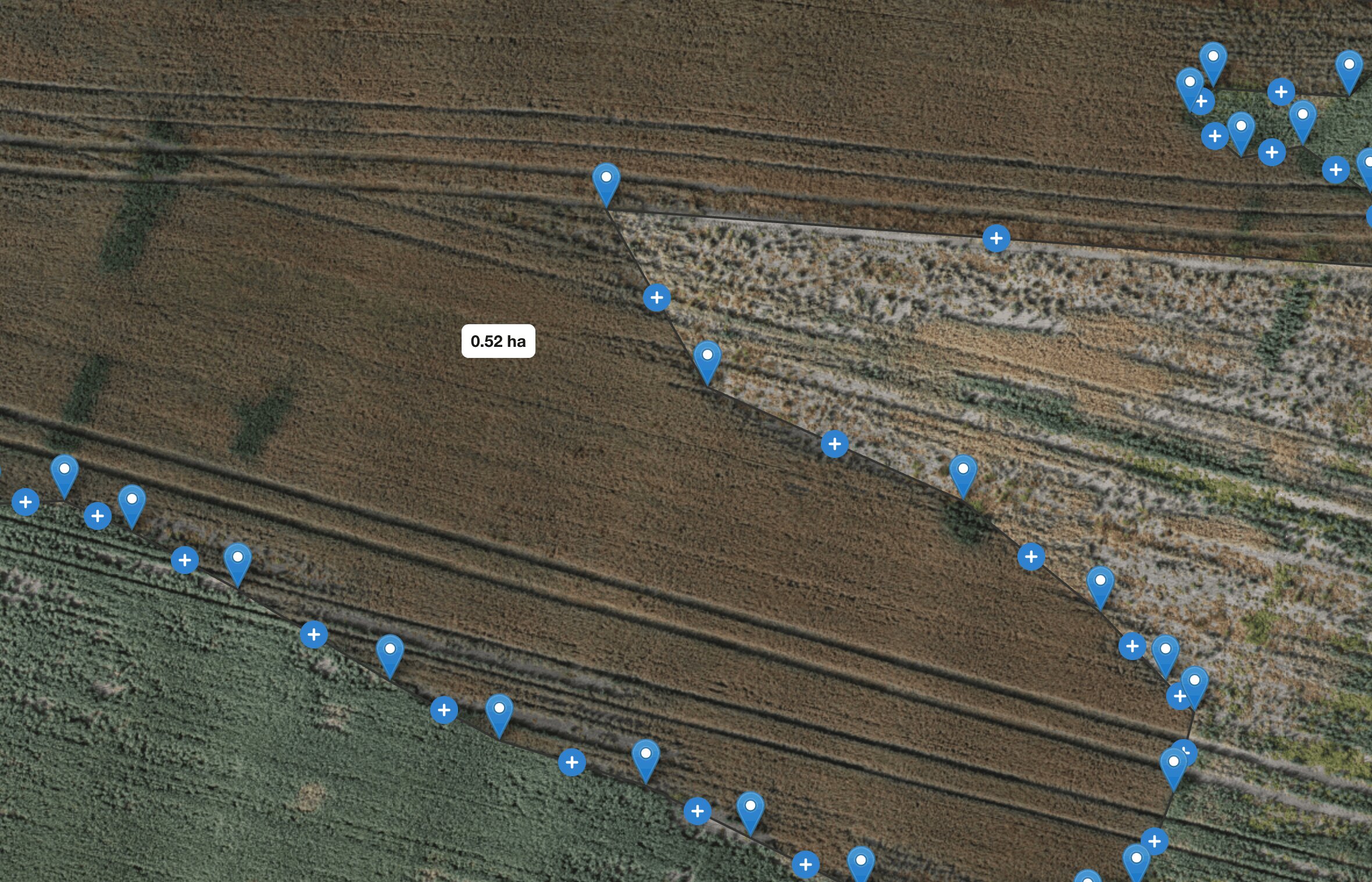
Manual measurement tools
Measure distances and areas on drone maps, and document conditions you want to follow up on.
Get started
You don’t necessarily need to own a drone. CropUp can be used with drone flights carried out by an advisor or drone operator.
Find a partner, or contact us and we’ll help you take the next step.
PARTNERS IN DENMARK
Advisors

Other partners